Get updates from The Developer straight to your inbox Yes, please!




NPPF: Why building homes near rail stations isn’t always a quick win
Just being close to a train station isn’t the only, or even the best, way to measure whether somewhere is well-connected or a good place to live, writes Aggie Morris, Planning Officer, Walk Wheel Cycle Trust


Housing estates built in the middle of nowhere – they’re bad for people, and they’re bad for our planet.
When you’re far from things you need every day – schools, shops, doctors’ surgeries, libraries and public transport – you rely on your car.
That means less choice about how you get around, more congestion and worse pollution.
It should be possible for everyone to get around actively. The planning system has a key role in that.
So, when the government announced plans to make it easier to build near rail stations in England, it was a step forward. In the draft National Planning Policy Framework for England, the government set out plans to encourage development near “well-connected” rail stations and discouraging it elsewhere.
This means that development will generally be permitted near rail stations and at higher densities than in other locations. Elsewhere, outside existing settlements, new development will be difficult.
But there’s a simpler and better way to achieve the same thing.
Just being close to a train station isn’t the only, or even the best, way to measure whether somewhere is well-connected or a good place to live. The bar is both too high and too low.
To qualify as “well-connected”, stations need to meet certain criteria: Four trains or trams per hour all day; two trains or trams per hour in one direction; within the top 60 travel-to-work areas by gross value added (basically the areas around large towns and cities).
In some areas, there may be some well-served stations and some which aren’t but still meet these thresholds. Planners should have more tools to steer development towards the very best locations.
The top 60 travel-to-work areas are where housing is particularly needed as that’s where there are more jobs. It’s great to unlock housing here, but the need for new homes is spread more widely across the country.
The government’s highlighted important issues with this proposal, but the details need work. Lichfields, a planning and development consultancy, have written about their concerns, with their modelling suggesting “up to 850,000 additional homes could be unlocked by widening the frequency criteria.”
The proposal raises a wider question. Are rail stations actually the best measure of how well-connected a place is?
Many stations were – often deliberately – built away from town or village centres. If you can get to work easily but not to school, a GP or library, then you don’t have transport choice.
Equally, some areas have frequent and reliable bus services without any rail infrastructure at all.
So, if we want to build homes in the right places, we need to look beyond stations.
Luckily, the government’s been working on a tool which could address this.
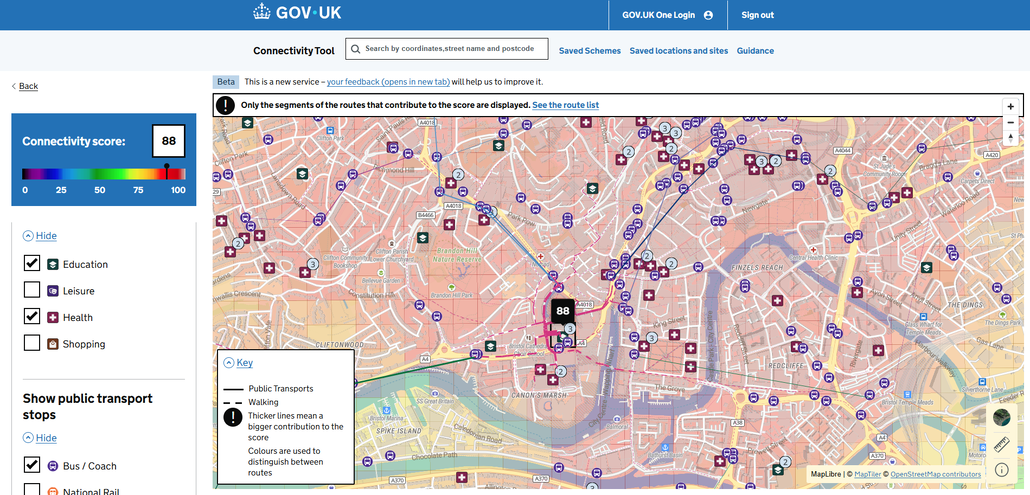
The Connectivity Tool maps how well every 100m area across England and Cymru is connected to jobs, services and amenities. It gives a score based on access, to the things people actually need.
You can break this down by transport mode and type of destination and see how access changes at different times of day.
The draft National Planning Policy Framework says the tool should be used for planning, but it’s a missed opportunity not to use it consistently when deciding where to build new homes.
The government should use specific levels of connectivity on the tool as the threshold. This would allow for a more nuanced but clearer approach.
It’d also remove the need for distinction between development within or outside existing settlements. Some areas within settlements are poorly connected, while some sites just beyond them are close to everything people need. This tool captures that reality.
You can also propose new transport infrastructure in the tool: with a new bus route, you can put in its route and timetable and see how it might change the connectivity score.
And you can see which services are contributing to different elements of the score. So, if planners see that a site isn’t close enough to schools, connectivity could be improved for new residents by building a new school.
Lichfields have already highlighted examples of well-connected sites near stations that are missed by the current criteria. I had a quick look at the Connectivity Tool to find a few more which aren’t well served by the government’s proposals.
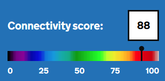
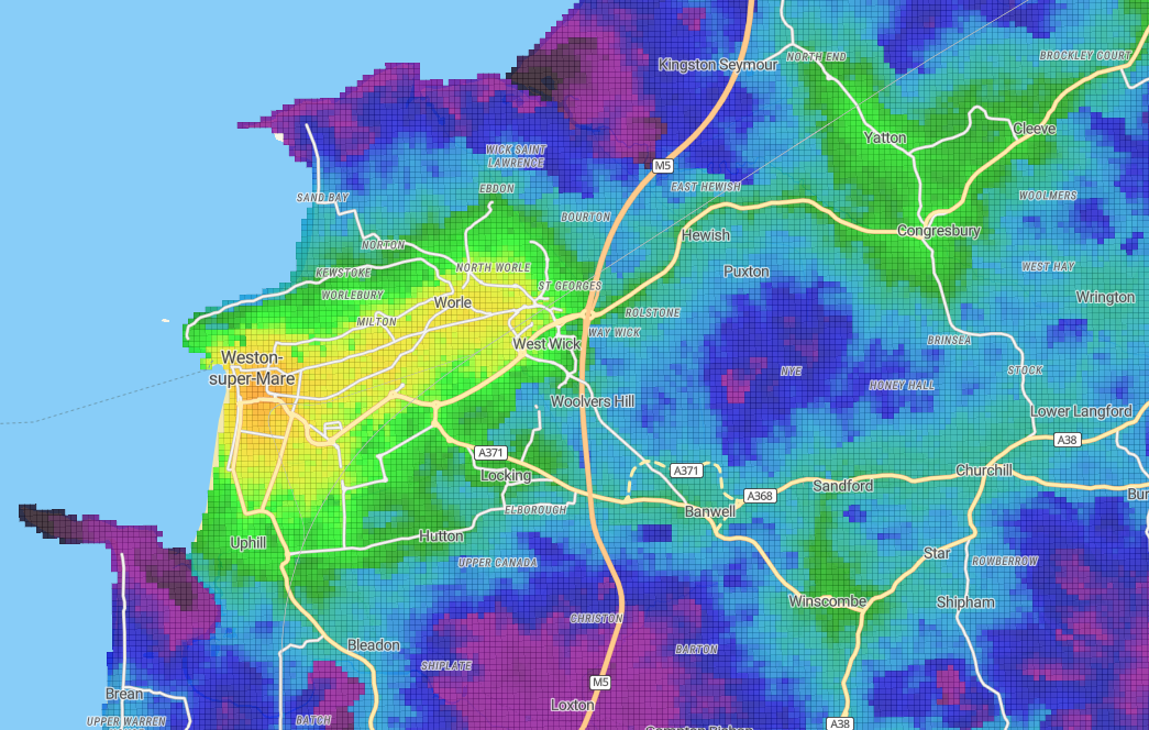
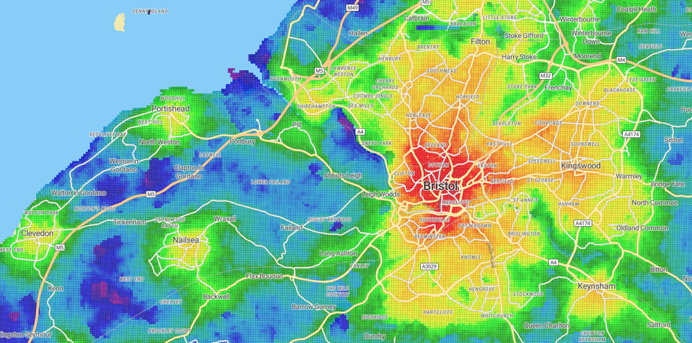
These are illustrative rather than specific development sites, but they show how the current approach doesn’t always prioritise the best-connected locations. I focused on sites on the edge of the settlements, where development is most likely. The scoring follows the visible spectrum, with violet for low connectivity through to red for high.
In the South West, Nailsea is within a top travel-to-work area and would see development encouraged, with a connectivity score of 64. Meanwhile, Weston-super-Mare sits outside that travel-to-work area but has several locations with scores of 68. One of these sites sits next to National Cycle Network Route 33, making it easy to walk, wheel or cycle into the town centre. It makes it easy for people to walk, wheel or cycle into the centre of Weston-super-Mare.
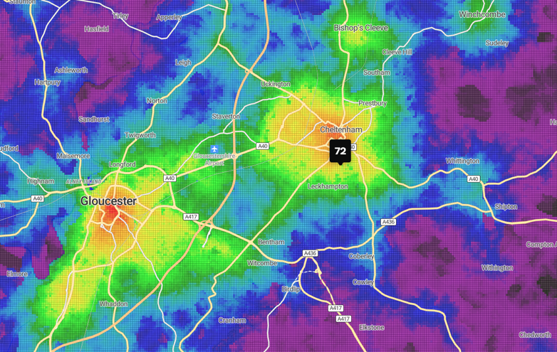
Cheltenham (72) and Gloucester (74) both score even higher. Cheltenham falls just outside the correct travel-to-work area so development outside its existing boundary would be banned by default. For a well-connected place, that feels like a missed opportunity.
There are more examples like this across the country. Places such as Cromer, Bridgwater, Boston and Workington all have stations and have well-connected sites on their edges, but wouldn’t qualify for the proposed housing boost.
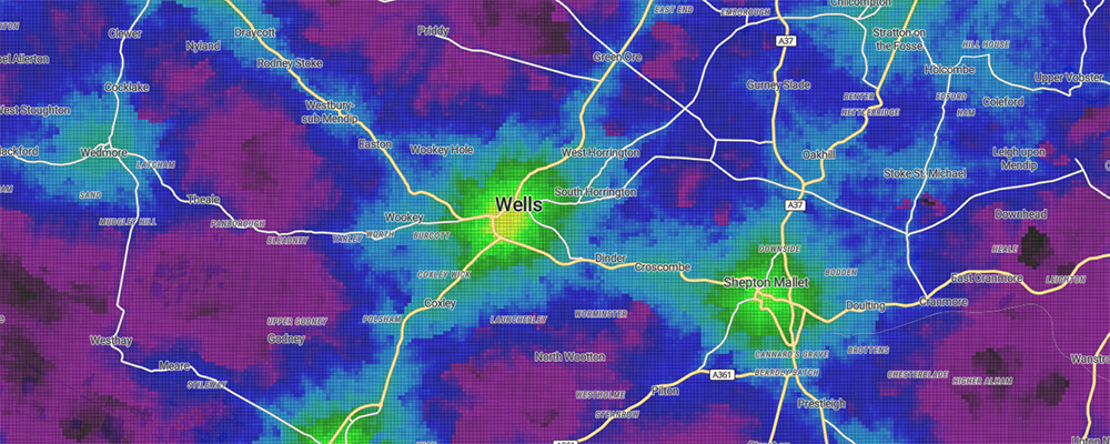
Not all well-connected places are on the rail network. Wells, for example, has no station but benefits from frequent bus services to Bristol, and a range of local services. Sites on its edge score up to 61, with National Cycle Network Route 3 providing quick access to the town centre.
Clevedon and Portishead are similar, and they’re within Bristol’s travel-to-work area. Portishead is due a railway station soon, so it’s an ideal place to build, but it doesn’t get the preferences that the NPPF provides. Hunstanton and Cockermouth are also relatively well-connected spots in this travel-to-work area but without a station.
Conversely, there are of stations in the top travel-to-work areas which aren’t well connected. Crediton has relatively low scores on the edge of the settlements, hovering around 60. Formby has similar scores.
The government is right to focus on how best to choose locations for new developments. And they’ve done a lot of the work – a rigorous tool takes years to create.
Now, it’s time for them to go all in on the Connectivity Tool, so they can make informed decisions about where to build next.
Aggie Morris is Planning Technical Officer at the Walk Wheel Cycle Trust, where this article was published first
Active travel Just one of the topics we’ll be talking about at the Festival of Place 2026 with keynote speaker and active travel commissioner Chris Boardman CBE speaking about how to shift behaviours and use the right words to unblock progress in UK towns and cities. Buy your ticket
If you love what we do, support us
Ask your organisation to become a member, buy tickets to our events or support us on Patreon
Sign up to our newsletter
Get updates from The Developer straight to your inbox
Thanks to our organisation members
© Festival of Place - Tweak Ltd., 124 City Road, London, EC1V 2NX. Tel: 020 3326 7238